an email from Ted Hill, a cousin:
Caroline Araminta Woods was born in Pennsylvania in 1849. She later moved to Iowa and married George Shaw in 1871. George was born in Wisconsin in 1848.
Caroline and George had five daughters:
Ethel Wayman
Lena Hale
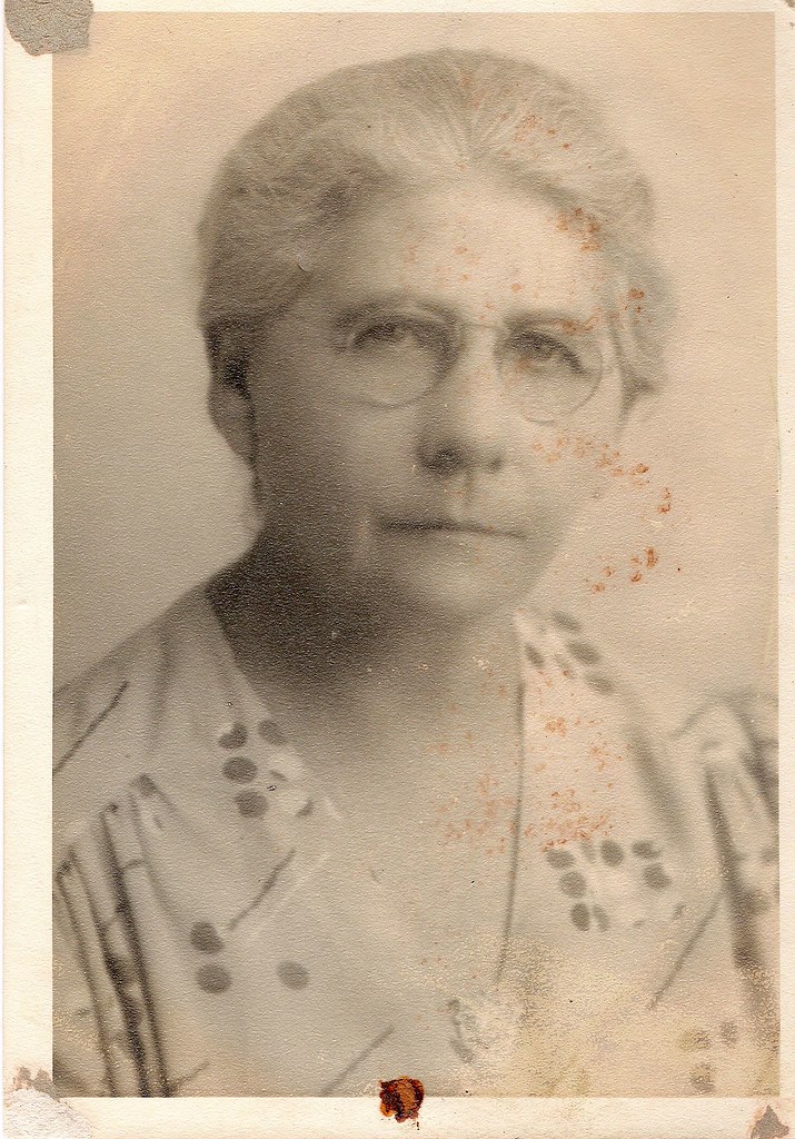
Florence Whitney (Jack Crowley's grandmother)
Addie Clark (Ruby's mother, Norman's grandmother)
Jessie Rockwood born 1878
George died in 1882 of Farmer's Lung due to working as a thresher for several years and inhaling the threshing dust.
At this point the four older daughters were each sent out to work as live-in housekeepers with various families in the area. Caroline went to work as a housekeeper for Samuel Wayman in Waucoma Iowa. She kept Jessie with her as Jessie was too young to be sent out on her own.
Eventually Samuel Wayman married Ethel, the eldest of the five sisters. At some point, perhaps in the 1890s, Samuel went on a real estate tour of North Dakota. Large tents were pitched on the prairie for the tour participants. Apparently there were coal outcroppings at the surface in several places and the land was being promoted as a mineral investment for its coal. Samuel bought several hundred acres.
Samuel and Ethel had no children. Samuel died before Ethel. In the mid 1920s, Ethel became ill and moved in with Jessie's family in Sapulpa OK. She died in Sapulpa and left the North Dakota land to her four younger sisters. At some point it was decided to sell the land but to keep the mineral rights. This was done to avoid paying annual property taxes. This may have happened at some point in the mid 1930s.
The land that we now own the mineral rights to are the following parcels:
East 1/2 Section 17, Township 144N, Range 95W, 5th PM, 320 acres.
East 1/2 Section 9, Township 144N, Range 95W, 5th PM, 320 acres.
SW 1/4 Section 9, Township 144N, Range 94W, 5th PM, 160 acres.
To understand what 144N, 95W means, see these article on Wikipedia:
http://en.wikipedia.org/wiki/Public_Land_Survey_System
http://en.wikipedia.org/wiki/Image:Plssinfo.gif
In this last link, note how the sections within a township are numbered starting in the upper right-hand corner moving right-to-left. Then the second row is numbered left-to-right, etc.
5th PM stands for Fifth Principal Meridian. It is a point in eastern Arkansas which is the x,y origin of the survey system. See this link for a map showing the 5th PM.
http://www.blm.gov/wo/st/en/prog/more/cadastralsurvey/meridians/5th_principal_meridian.html
Each township is a six-mile by six-mile square. The townships form an x-y grid. For example 144N, 95W refers to the township that is 144 townships north and 95 townships west of the origin point in Arkansas. All three parcels are in Dunn County North Dakota. I believe that the townships also have names but I have not yet been able to find out what they are. Normally each township is simply referred to by its coordinates. There are thirty-six sections per township, each a one-mile by one-mile square which is 640 acres.
The following link shows all property owners in Dunn County in 1916:
http://www.odessa3.org/collections/land/nodak/link/dunn16.txt
1916 Plat Map Index - Dunn County ND
Wayman, Samuel 144N 95W 9, 17, 29
This seems to indicate that Samuel and Ethel originally owned section 29 in 144N 95W. However we have no mineral rights there now but we do have mineral rights in section 9 of township 144N 94W.
When an oil company gets a permit from the state to drill, the land is grouped into 'drilling units.' Typically a drilling unit is 1280 acres, i.e. two sections. For example, our section 17 is joined with section 8 to its north to form a single drilling unit.
Now here is something that I had not realized: we stand to collect royalties from any well drilled within the drilling unit, whether or not it is drilled on the land that we have mineral rights to. Because we have rights to 320 acres of the 1280 acre drilling unit, we get ¼ of the royalties paid out from the entire unit.
This link gives quite a bit of detail on how to calculate royalty payments.
http://groups.google.com/group/bakken-shale-discussion/browse_thread/thread/a5077639fe9f84a1
The leases that my mother signed specify a 1/6 royalty. This means that for every six barrels of oil that are pumped, that the value of one barrel is paid in royalties. More specifically, the value of one barrel minus transportation charges and state of North Dakota taxes.
And because we own rights to ¼ of the unit, we should receive 1/24 of gross from the entire unit. Here 'we' means the heirs of Samuel and Ethel Wayman. Because Jessie Rockwood inherited a ¼ interest, and because she passed on her mineral rights equally to her four children, my mother will receive a 1/384 interest calculated as follows:
1/6 royalty
¼ of the acreage of the drilling unit
¼ passed to Jessie Rockwood
¼ passed to each of her children
Those in succeeding generations will of course receive less. For example Jim Rockwood will receive a 1/768 interest in this drilling unit.
Currently, there are two wells being drilled in the unit which encompasses our section 17. So if both wells together would produce 384 barrels per day, my mother would receive the value of one barrel per day. At current prices, I would estimate this to be about $100 per day. From what I gather on the web, North Dakota wells normally produce somewhere between 100 to 400 barrels a day; some more, some less.
If the wells currently being drilled are successful, I would expect that more wells will eventually be drilled in our drilling units.
The following link is updated frequently with current prices.
http://www.rmoj.com/
As of July 2nd, it gives the value of North Dakota crude between $122 and $133 per barrel. There it refers to the North Dakota oil as Williston Basin crude. I'm not sure if the wells in Dunn County are producing sweet or sour crude.
So far there are three wells that we should receive royalties from and none of them are directly on the acres where we have mineral rights. All three of these wells currently have confidential status. So we don't know if the wells are actually producing yet, or in fact if drilling has been completed. We just know that the permit to drill was issued. Typically an oil company can keep the status confidential for six months. One of the wells in the section 17 unit is schedule to come off the confidential list in September, the other one in October. The third well is in the drilling unit where we only have a ¼ section interest which is 1/8 of the drilling unit. So for this well we will get only half as much royalty as from the section 17 unit. I haven't yet been able to find out when this one comes off the confidential list.
1 comment:
I know the feeling,we have one too...Wow..
Post a Comment